Skip to main content

Every 1–2 minutes in the U.S., a utility is damaged due to errors in mapping or unmarked infrastructure. These mistakes can lead to safety hazards, project delays, and financial losses averaging $56,000 per strike. The solution? Better utility mapping methods.
Here’s what works:
Accurate mapping saves time, money, and lives. By integrating these practices, utility strikes and costly mistakes can be minimized.
To tackle errors in utility mapping, it's crucial to first understand their root causes. According to the Common Ground Alliance (CGA), improper utility locating and excavation practices are responsible for a staggering 68% of construction-related damages. Despite advancements in technology, several persistent factors continue to challenge the industry.
One of the biggest challenges in utility mapping comes from outdated or inaccurate records. Many utility maps fail to reflect recent updates or contain errors that lead to costly mistakes. For instance, poor record accuracy has been linked to thousands of utility strikes.
Studies reveal significant discrepancies between recorded and actual utility locations. For example, Subsurface Utility Engineering (SUE) investigations found between 12% and 160% more utility footage than what was documented in One Call records. In one case, only 32% of 28,577 feet of utilities recorded by One Call were accurate to within 2 feet of SUE data. Even more alarming, 21% of utilities over a 1.2-mile stretch deviated by more than 20 feet between the two datasets, drastically increasing the risk of strikes.
Historical incidents further highlight the risks of relying on outdated maps. These errors often stem from inaccurate field data being uploaded into GIS systems or from flawed as-built documentation, creating a false sense of security.
"I frequently hear that other platforms are great, except for the accuracy of the data. I have heard of lines being over 30' off, yes, 30 feet!!! Yes, the line was collected, but the accuracy is almost useless. These [GIS] platforms aren't acting as a living, breathing database like SiteMap® being tied to GPRS scanning services provided for them." – Nate Stair, GPRS Market Segment Leader
Human mistakes are a leading cause of utility mapping errors, accounting for 66% of locating issues. This translates to nearly 34,000 underground utility strikes annually, with these errors contributing to 24% of all underground utility damage.
Errors often occur during the data collection process. Field personnel may misread detection equipment signals, improperly document findings, or fail to follow established procedures. Communication breakdowns between teams can make matters worse. For example, in 2016, a construction crew in California accidentally hit an electrical line, causing a power outage. The incident was traced back to poor communication between the utility mapping team and the construction crew.
Relying on a single detection method can leave significant blind spots in utility mapping. Using inappropriate technology - or skipping it altogether - can result in inaccurate maps. Different utilities require specific detection methods; for example, tools effective for metallic pipes may not work for fiber optic cables or other non-conductive materials.
This issue is particularly evident with fiber optic cables, where up to 40% of damages occur due to outdated or insufficient detection methods. Traditional electromagnetic locators, while effective for metallic utilities, cannot detect materials like plastic pipes, fiber optic cables, or concrete conduits.
"When are we going to step up to the challenge of locating lines that we can grab that data, it's accurate, and we can be right? Because as we all know, we can use any line locator in the world, but until you see that pipe, it's not there." – Douglas Beck, West Texas Gas
To improve accuracy, combining multiple detection methods is essential. Ground-penetrating radar (GPR), for instance, can boost utility location accuracy by up to 30%, significantly reducing excavation-related incidents. However, many projects still rely on single-method approaches due to budget constraints or lack of awareness.
Environmental factors add another layer of complexity to utility mapping. Soil type, moisture levels, and urban infrastructure density can all interfere with detection efforts. For example, clay soil can weaken signals, while sandy soil scatters them, leading to false readings. High moisture content can further disrupt ground-penetrating radar signals, reducing their effectiveness.
Weather conditions also play a role. Heavy rain or snow can alter signal behavior and obscure utilities. Additionally, electromagnetic interference from power lines or radio transmitters can disrupt readings, and vibrations from nearby construction activities can affect accuracy. Urban environments, with their crowded underground networks, present unique challenges for precise mapping.
"Utility locating accuracy is influenced by various factors, including soil conditions, utility depth, interference, and equipment." – Util-Locate
Overcoming these environmental challenges requires flexible strategies and specialized techniques. Professional utility locators must adapt their methods based on conditions. Companies like Legacy HydroX address these issues by using non-destructive hydro-excavation techniques, which provide visual verification of utility locations and remove much of the guesswork in complex environments.
To tackle the common causes of utility mapping errors, these strategies provide practical solutions that project managers and professionals can adopt. By addressing the underlying issues, these approaches aim to make utility mapping more accurate and reliable.
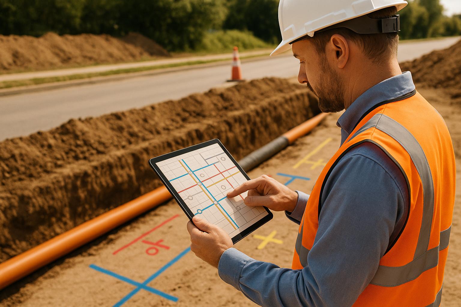
Start with a thorough utility survey early in the project. A utility survey involves assessing underground utilities and structures within a specific area, often a construction site. Conducting these surveys during the initial stages of planning is both cost-effective and critical for success.
Jim Anspach, P.G., Dist.M.ASCE, NAC, highlights the importance of leveraging all available resources:
"Use all appropriate means to figure out where utilities are. At points where you need really good data, you might have to dig it up and look at it. In between, you've got records, professional judgment, common sense, and geophysics to give you an idea of what's there."
Combine multiple data sources. Use historical records, utility databases, field observations, and visual verification to capture discrepancies that might be overlooked by relying on a single source.
Hire qualified experts. Utility surveys demand specialized skills and equipment. Partnering with experienced professionals ensures accurate results that comply with industry standards. These experts understand the nuances of detection tools and adapt their methods to suit site-specific conditions.
After completing the survey, employ various detection tools to ensure no utility is missed.
Diversify detection methods for better coverage. Each detection technology has its strengths and weaknesses. For example, electromagnetic (EM) locators are effective for metallic utilities, while Ground Penetrating Radar (GPR) works for both metallic and non-metallic materials. GPR can pinpoint the location and depth of objects within 10% accuracy.
| Technology | Advantages | Limitations |
|---|---|---|
| EM Locators | Lightweight, quick to use; effective for conductive materials | Needs conductive utilities or tracer wires; signals can overlap on metal utilities |
| Ground Penetrating Radar | Detects both metallic and non-metallic utilities; provides depth accuracy | Performance depends on soil conditions; cannot identify material type |
| Magnetic Locators | Affordable; capable of deep detection | Limited to iron/steel objects; may detect irrelevant metal |
Cross-check findings. Combining multiple methods gives a clearer picture and reduces the chances of utility strikes. For instance, if GPR spots a non-metallic utility, EM locators can confirm whether nearby metallic utilities could interfere with excavation.
Verify with utility providers. Confirm your findings with utility companies to identify hidden utilities, such as abandoned lines or recent installations, that may not appear on detection tools.
Once the utilities are mapped, validate their locations with non-destructive methods.
Visual confirmation is key. Detection technologies are helpful, but physically verifying the utility's location is essential. Non-destructive methods, like hydrovac excavation, allow you to safely expose underground utilities without damaging them.
Hydrovac excavation ensures precise verification. This technique uses pressurized water to uncover utilities, reducing the risk of damage to existing infrastructure. Companies like Legacy HydroX specialize in hydro-excavation, offering a safe and effective way to visually confirm utility locations.
Minimize excavation risks. Vacuum excavation is a safer alternative to traditional digging methods, significantly reducing the chance of utility strikes. This method is particularly useful in areas with dense utility networks or near critical infrastructure.
Document everything. When utilities are exposed, take photos and measurements to record their exact location, depth, and condition. These records are invaluable for updating utility maps and planning future projects.
Accurate records prevent costly errors. Inaccurate or outdated utility data accounts for 94% of utility strikes, with each incident costing an average of $56,000 and causing 6–8 weeks of delays. Keeping records up-to-date is your last line of defense against mapping errors.
Adopt the 90-day rule. Utility drawings lose accuracy after about 90 days due to frequent changes in underground infrastructure. Regularly reviewing and updating these drawings is essential for safety and efficiency. As Green Engineering Ltd. explains:
"Utility drawings are a critical foundation for safe and successful project delivery. Inaccurate or outdated utility information can lead to hazardous service strikes, significant delays, and spiraling project costs, especially at high voltage."
Use digital GIS tools. Real-time Geographic Information System (GIS) solutions make it easier to manage and update utility data, reducing the risk of errors caused by outdated information.
Account for private utilities. Private utilities represent over 60% of all utility lines in the U.S., yet they’re often overlooked. Update your Ground Disturbance Policy to include the accurate documentation of all public and private utilities before excavation.
Train your team. Even the best maps can’t prevent errors if crews aren’t properly trained. Educate construction teams on reading utility maps, recognizing unmarked utilities, and knowing when to pause work for further verification.
Modern utility mapping has embraced advanced technologies to create precise maps, significantly reducing the risk of costly utility strikes.
Ground Penetrating Radar (GPR) stands out as a leading tool, capable of detecting both metallic and non-metallic utilities by sending radar pulses into the ground. It works hand-in-hand with electromagnetic locators, which are particularly effective for identifying conductive materials like metal pipes and cables. Together, these technologies provide a more complete picture of underground utilities.
Geographic Information System (GIS) platforms, such as Esri's ArcGIS and specialized tools like GPRS’s SiteMap®, take this data to the next level. These systems integrate detection data into detailed, highly precise maps. For instance, SiteMap® boasts an impressive 99.8%+ accuracy rate in utility mapping data.
The accuracy of these platforms can vary dramatically. Nate Stair, Market Segment Leader at GPRS, highlights this disparity:
"I frequently hear that other platforms are great, except for the accuracy of the data. I have heard of lines being over 30 feet off. Yes, 30 feet!!! Yes, the line was collected, but the accuracy is almost useless. These [GIS] platforms aren't acting as a living, breathing database like SiteMap®, being tied to GPRS scanning services provided for them."
Integrating GPS with GIS mapping systems further enhances precision by syncing accurate positioning data with utility maps. This streamlines the process of locating utilities and storing critical information.
These advancements pave the way for methods like hydrovac excavation and real-time mapping, which continue to refine the accuracy and reliability of utility mapping.
Hydrovac excavation employs pressurized water and vacuum systems to safely and precisely expose underground utilities. This non-invasive method has revolutionized utility verification.
Not only does hydrovac excavation drastically reduce the risk of utility strikes, but it also completes tasks up to 10 times faster than traditional digging methods. Safety is another major benefit - trench-related hazards, which nearly doubled in 2016 compared to previous years, are significantly reduced. This method minimizes risks like explosions, electrical shocks, and exposure to hazardous materials.
By uncovering subsurface infrastructure with high precision, hydrovac excavation supports detailed measurements of utility position, depth, type, and condition. Companies like Legacy HydroX specialize in hydro-excavation services, offering a non-destructive approach that aligns with the Quality Level A mapping standards set by the American Society of Civil Engineers (ASCE).
Urban areas, where utilities are often tightly packed, benefit greatly from this technology. Traditional excavation in these environments can be risky and disruptive, but hydrovac technology allows for safe, precise work while leaving the site cleaner and more organized.
Expanding on detection and verification tools, real-time mapping solutions bring a new level of accuracy and efficiency. These systems provide instant results, ensuring workflows can keep up with the fast pace of modern construction demands.
Mobile GIS applications allow field teams to collect and upload data directly from smartphones or tablets. This eliminates the delays of traditional methods, where data often had to be processed later, and ensures utility mapping records stay up-to-date.
Web-based GIS software further improves collaboration by enabling office staff and field crews to access and manage mapping data through a browser. This enhanced accessibility helps reduce miscommunication - an issue responsible for nearly half of all rework on U.S. construction sites.
Real-time integration of data from sensors and drones into GIS systems enables continuous monitoring of site conditions. For example, during a 150-acre community college project, GPRS provided precise utility locating and mapping services that helped a contractor stay on schedule, within budget, and maintain safety while installing water lines.
Accurate GIS data is essential for minimizing damage and managing costs. The urgency for precision is underscored by the alarming statistic that a utility strike occurs approximately every 62 seconds in the U.S., with over 163,000 incidents reported in 2022. Real-time mapping solutions play a critical role in improving data management and ensuring timely access to essential information.
Minimizing errors in utility mapping isn’t just about using cutting-edge technology - it’s about pairing those tools with solid risk management and quality control practices. Without these, even the best equipment can fall short.
Risk assessment is the foundation of safe and efficient utility mapping. By identifying hazards and planning mitigation measures before excavation begins, teams can avoid costly mistakes. This process typically includes three steps: spotting potential risks, analyzing their impact with specialized tools, and crafting mitigation strategies. Tools like risk assessment matrices help project managers evaluate the severity and likelihood of hazards, allowing them to focus on the most critical issues. Collaboration is key - when project managers, utility providers, and experts work together, they can address risks more effectively and in a timely manner.
A well-executed risk assessment naturally leads to better quality control practices, ensuring that safety and accuracy remain priorities throughout the project.
Strong quality control measures are essential for accurate and safe utility mapping. Regular calibration of equipment, peer reviews, and strict quality checks help reduce the chance of utility strikes. Field verification methods, such as potholing, provide direct confirmation of utility locations and conditions, ensuring that mapped data matches what’s underground. Non-destructive techniques like hydro-excavation further support this verification process.
Another critical aspect of quality control is documentation. Keeping detailed records of equipment settings, field conditions, and audits provides a reliable trail for resolving discrepancies and improving future projects. The principle of "Data Control = Damage Control™" highlights how thorough quality control can enhance safety, efficiency, and cost management by preventing rework and delays.
Even with the best tools and processes, well-trained personnel are crucial to executing utility mapping protocols effectively. Continuous training ensures field teams stay up to date with the latest technologies, safety measures, and industry best practices. For example, they must learn to properly use and calibrate multi-frequency locators, ground-penetrating radar (GPR), and electromagnetic induction equipment. Safety training is equally important, covering utility hazards, personal protective equipment (PPE), and emergency response procedures.
Training also extends to soft skills and collaboration. Field personnel should know how to conduct thorough site surveys, document utility data accurately, and work seamlessly with utility companies, local authorities, and contractors. Communication training and familiarity with collaborative platforms help keep all team members on the same page, reducing the risk of mapping errors. Regular refresher courses ensure teams stay aligned with industry standards and new technologies, enabling them to maintain accuracy and adapt to changing project needs.
Reducing errors in utility mapping calls for a mix of cutting-edge technology, tested methods, and skilled professionals. In 2022 alone, the U.S. saw about 532,000 excavation-related damages, each costing an average of $3,500. These numbers highlight the serious financial and safety risks involved.
The best results come from using multi-method detection strategies that integrate technologies like ground-penetrating radar (GPR), electromagnetic induction, and GIS mapping. For instance, GPR can boost utility location accuracy by up to 30%, significantly cutting down excavation-related accidents. But technology isn’t the whole solution. Non-destructive verification methods, such as hydrovac excavation, are crucial for confirming utility locations before large-scale digging begins.
Accurate and updated records are equally important, particularly for preventing costly fiber optic damages. Regular equipment calibration, detailed site surveys, and thorough documentation lay the groundwork for reliable mapping, safeguarding both workers and infrastructure.
Human expertise, however, remains irreplaceable. Skilled field personnel who can operate various detection tools, navigate environmental challenges, and collaborate with utility companies and contractors are essential. As John Campbell from T2 Utility Engineers aptly puts it:
"Anyone who wants to dig safely needs utility data...And we need as much as we can get as early as possible".
These core practices form the backbone of successful and safe utility mapping projects.
The utility mapping industry is on a growth trajectory, projected to expand from $3.2 billion in 2020 to $5.3 billion by 2025. This growth underscores the increasing importance of accurate mapping as a strategic investment.
By adopting comprehensive mapping practices that combine advanced detection technologies, non-destructive verification, and expert training, organizations can reduce errors, cut costs, and prioritize safety. Partnering with experienced professionals who offer integrated services can make all the difference.
Legacy HydroX, for example, specializes in hydrovac excavation and utility locating, providing the critical verification needed to turn mapping data into actionable, safe excavation practices. These services help minimize risks, control costs, and ensure projects run smoothly while protecting essential infrastructure.
Using a variety of detection methods in utility mapping comes with some clear benefits. When you combine tools like Ground Penetrating Radar (GPR), electromagnetic locators, and magnetic detection, you can cross-check the data for better accuracy. This approach helps reduce the chances of overlooking underground utilities or mistakenly identifying something that isn’t there.
By using multiple methods, you’re also prioritizing safety, as it lowers the risk of accidentally hitting utilities. Plus, it can cut costs by avoiding damage and delays that might otherwise disrupt your project. Altogether, this strategy helps keep your project on track, protects your team, and safeguards the surrounding infrastructure.
Hydrovac excavation offers a safer and more accurate way to map underground utilities. By using pressurized water and a vacuum system, it carefully exposes buried utilities without risking damage. This method not only ensures precise digging but also provides clear visual confirmation of utility locations, significantly lowering the chances of accidental strikes or errors in mapping data.
With complete visual verification, hydrovac excavation removes the uncertainty that comes with relying on outdated or incomplete records. Its non-invasive nature makes it especially useful in busy or complicated underground spaces, where accuracy is critical.
Keeping utility records current is key to maintaining accurate data, staying compliant with regulations, and avoiding expensive mistakes during utility mapping projects. Updated records also mean faster problem-solving, smoother project planning, and dependable documentation for audits or resolving disputes.
In the United States, it's recommended to review and update utility records every month. Make sure to keep these records for at least one to two years to meet industry standards and maintain proper documentation. Regular updates not only simplify operations but also help prevent errors in vital projects.
Lorem ipsum dolor sit amet, consectetur adipiscing elit, sed do eiusmod tempor incididunt ut labore et dolore magna aliqua. Ut enim ad minim veniam, quis nostrud exercitation ullamco laboris nisi ut aliquip ex ea commodo consequat. Duis aute irure dolor in reprehenderit in voluptate velit esse cillum dolore eu fugiat nulla pariatur.
Block quote
Ordered list
Unordered list
Bold text
Emphasis
Superscript
Subscript